
About the Port Macquarie Electorate
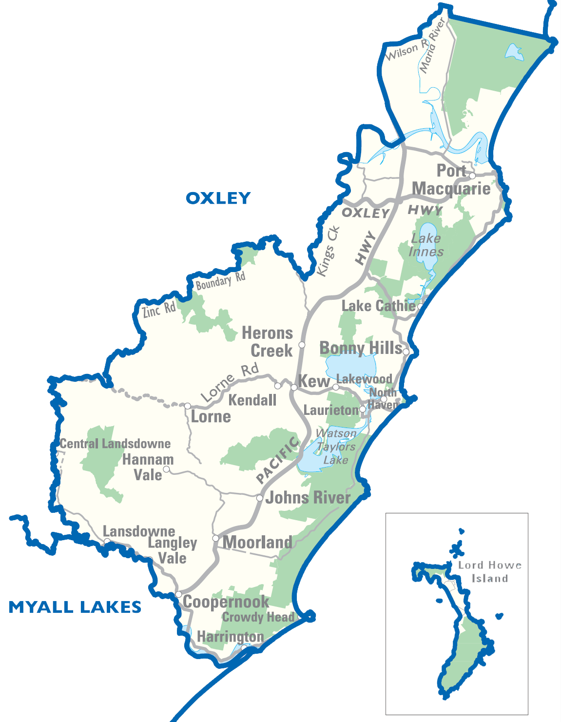
From Limeburners Creek Nature Reserve in the north to Harrington in the south; and from Hannah Vale in the west to the New South Wales coast in the east (inclusive of Lord Howe Island and all islands lying off the coast of the district).
Located within Hastings Statistical Agricultural Subdivision.
Principal towns: Batar Creek, Black Creek, Bobs Creek, Bonny Hills, Camden Head, Comboyne, Coopernook, Coralville, Crowdy Bay National Park, Crowdy Head, Deauville, Diamond Head, Dicks Hill, Dunbogan, Fernbank Creek, Grants Beach, Hannam Vale, Harrington, Herons Creek, Johns River, Jolly Nose, Kendall, Kew, Lake Cathie, Lake Innes, Lakewood, Langley Vale, Laurieton, Limeburners Creek, Logans Crossing, Lord Howe Island, Lorne, Middle Brother, Moorland, North Brother, North Haven, North Shore, Port Macquarie, Rossglen, Sancrox, Stewarts River, Swans Crossing, Thrumster, Upsalls Creek, Waitui, West Haven.
Area: 1,227 sq km
Enrolments to vote: 61,197
Geographic Information
Includes partially or wholly the following localities and postcodes.
Localities: Batar Creek, Black Creek, Bobs Creek, Bonny Hills, Camden Head, Coopernook, Coralville, Crowdy Head, Deauville, Diamond Head, Dunbogan, Fernbank Creek, Grants Beach, Hannam Vale, Harrington, Herons Creek, Johns River, Jolly Nose, Kendall, Kerewong, Kew, King Creek, Lake Cathie, Lake Innes, Lakewood, Langley Vale, Lansdowne Forest, Laurieton, Limeburners Creek, Logans Crossing, Lord Howe Island, Lorne, Middle Brother, Moorland, North Haven, North Shore, Port Macquarie, Rawdon Island, Riverside, Rossglen, Sancrox, Stewarts River, Swans Crossing, Thrumster, Upsalls Creek, Waitui, West Haven.
Postcodes: 2426, 2427, 2430, 2439, 2443, 2444, 2445, 2446, 2898
For more detailed information see - https://www.elections.nsw.gov.au/District-profiles/Port-Macquarie